Moab, Utah, is Dinosaur Central. We got down there again in October, despite the pandemic (Moab is under mask orders, and people were pretty good about social distancing on trails), and visited a few more dinosaur tracksites.
The Moab Area Travel Council has great info on area dino attractions (there are many). Descriptions of how to find the tracks are from their site.
Poison Spider Tracksite:
From the center of Moab, travel north on Hwy 191 for 5.9 miles and turn left on Hwy 279. Continue 6 miles to the Poison Spider trailhead. Parking lot is up on the top of the hill.
From the parking lot there is a short hike up the hill to a spot where a large slab has fallen off its opposite, showing theropod (3-toed dinosaur) tracks. The upper face has indentations from the footprints, while the lower face has raised molds where sediment filled in the actual tracks and then fossilized. The tracks were left by small (turkey-sized) and large (5’ tall at the hip) two-legged, meat-eating dinosaurs walking along a lakeshore 190 million years ago in the Jurassic.
 |
| The upper face, with the direct footprints. |
 |
Detail of the footprints.
|
 |
The lower face, which is actually the rock layer which overlaid the tracks.
|
Willow Springs Tracksite:
From Moab, go north on Hwy 191 for 12 miles. Turn right onto the Willow Springs Road, off US Highway 191. 1.4 miles – take the left fork to Willow Springs. 1.7 miles – stay right on the main road and continue straight towards the Klonzo Trails area. 2.9 miles – stay right. 3.4 miles – arrive at tracksite.
Be cautious driving to this site; the unpaved road crosses a large sandy wash that will be dangerous after rains.
This is an older exposure, so some of the tracks are fairly weathered, but they are still easy to see. There are tracks from theropods (two-legged meat eaters), sauropods (big long-necked herbivores), and ornithopods (smaller herbivores). The tracks date to 165 million years ago.
 |
Sauropod track
|
 |
Trackway with geologist for scale.
|
 |
Theropod track
|
 |
Two crossing trackways
|
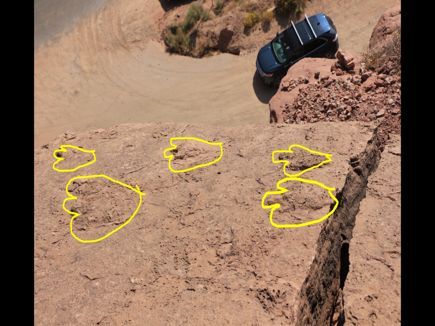
Bull Canyon Overlook Tracksite:
From Moab, go north on US Hwy 191 for 2.5 miles to the intersection of UT-128 (River Road). Turn right and head east 15.5 miles. At the La Sal Loop Road intersection (turn to Castle Valley) turn right and continue 10.7 miles. Continue on this road (FR207), do not follow the La Sal Loop Road signs when they turn right (southwest). Continue 5.4 miles passing the signs for Fisher Mesa. Approximately ½ mile beyond the Fisher Mesa turn park in the lot on the left (northeast) just before the road turns to dirt.
This site is up in the forested mountains of Manti-La Sal National Forest. Getting there is over an hour’s drive, but it’s worth it. The short trail is immediately adjacent to the parking lot. Some of the tracks are on the top of a thousand-foot cliff, making it look like the huge dinosaur just ran straight off the cliff to plummet to his doom. Of course, the landscape was different 200 million years ago—he walked along a sandy shore, and only later did the rocks uplift.
 |
It looks like this big theropod just ran right off the cliff.
|
 |
Theropod track (huge!) with my foot for scale.
|
 |
Big trackway; each track is about four feet apart.
|


No comments:
Post a Comment